 Kartenbuch über den den Streckenverlauf des Camino de Santiago von St. Jean Pied de Port über Pamplona bis Santiago de Compostela. Jede Etappe mit eigenem Kartenausschnitt, Alternativrouten, Kilometrierung, Streckencharakteristik, Höhenprofil, Übernachtungs-Adressen. Detailpläne für größere Ortschaften, Sehenswürdigkeiten. Achtsprachige Ausgabe: Englisch, Spanisch, Portugiesisch, Deutsch, französisch, Italienisch, Niederländisch, Polnisch. Gewicht 120 g. A pocket-sized, multilingual guide for the pilgrimage from St Jean to Santiago de Compostela. A complete set of maps and town plans make up this indispensible guidebook for spiritual seekers and travelers wishing to walk the way of Saint James. Covering the sacred route from St. Jean Pied de Port to Santiago, including the Finisterre extension for modern-day pilgrims who wish to reach the ocean, this portable book of maps makes the perfect companion for adventurers attempting to heed the spiritual calling. Revised and updated to offer the most recent information, this exploration is light enough to carry while walking long distances each day. The maps show the location of all pilgrim hostels en route, the distances between villages, and points of interest, as well as counter guides, alternative routes, and accommodations.  Kartenbeispiel Kartenbeispiel
|
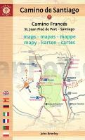
Camino de Santiago - Maps - Mapas - Cartes St. Jean Pied de Port - Roncesvalles - Santiago de Compostela - Finisterre - by John Brierley - Caminoguides Findhorn Press
EAN / ISBN: 9781912216291
Preis: EUR 19.90
|
|


